Log in
All resources
Create a design
9,296 Free Artworks of Map Collection
bibliothèque nationale de france
a map of the british empire in america with the french and spanish settlements adjacent thereto
maps of the islands of greece by marco boschini (1658)
marco boschini
joan blaeu
metropolitan museum of art
copper engraving print
british library
eran laor cartographic collection
national library of poland
bibliothèque nationale de france
maps by tomas lopez
maps by willem and johannes blaeu
old maps of quercy
maps of the islands of greece by marco boschini (1658)
old maps of euboea
regency revival genre paintings
emil brack
birds-eye view of seattle, 1884
lithograph
maps of persia by mercator-hondius
eran laor cartographic collection
maps of the americas by mercator-hondius
eran laor cartographic collection
maps of antwerp by braun & hogenberg
maps of antwerp city walls
atlas ou representation du monde universel t. 1 (1633)
maps by hendrik hondius the younger
atlas ou representation du monde universel t. 1 (1633)
maps of england by gerardus mercator
old maps of norway
guillaume sanson
maps made in the 17th century
europa centro-orientale
maps by nicolas sanson
red ruthenia
francesco nicolini
old maps of ikaria
19th-century maps of andalusia
mapa general de españa (1802)
atlas ou representation du monde universel t. 1 (1633)
maps by hendrik hondius the younger
book covers from the british library mechanical curator collection
books about africa
maps from gallica
guides joanne
university of amsterdam
map of amsterdam, 1544
maps from gallica
guides joanne
drawings by johan frederik clemens in the statens museum for kunst
gray wash
atlas ou representation du monde universel t. 2 (1633)
maps by hendrik hondius the younger
atlas ou representation du monde universel t. 2 (1633)
1630s maps of lower saxony
prints by william hogarth in the british museum
realism
17th-century maps of pembrokeshire
maps by jodocus hondius ii
17th-century maps of west africa
1650 maps of africa
templa diversa
mannerism
templa diversa
mannerism
paintings by nakabayashi chikutō in the metropolitan museum of art
19th-century paintings of waterfalls
paintings by nakabayashi chikutō in the metropolitan museum of art
19th-century paintings of waterfalls
oberlausitzkarte, schenk, 1759
köbeln/kobjelin
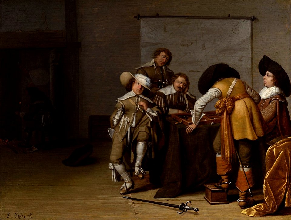
dutch paintings in the staatliches museum schwerin
paintings by pieter symonsz. potter
portrait paintings in the landesmuseum württemberg, stuttgart
nicolas guibal
maps by thomas kitchin
maps of wales
17th-century paintings in the national museum in wrocław
merry company paintings by anthonie palamedesz.
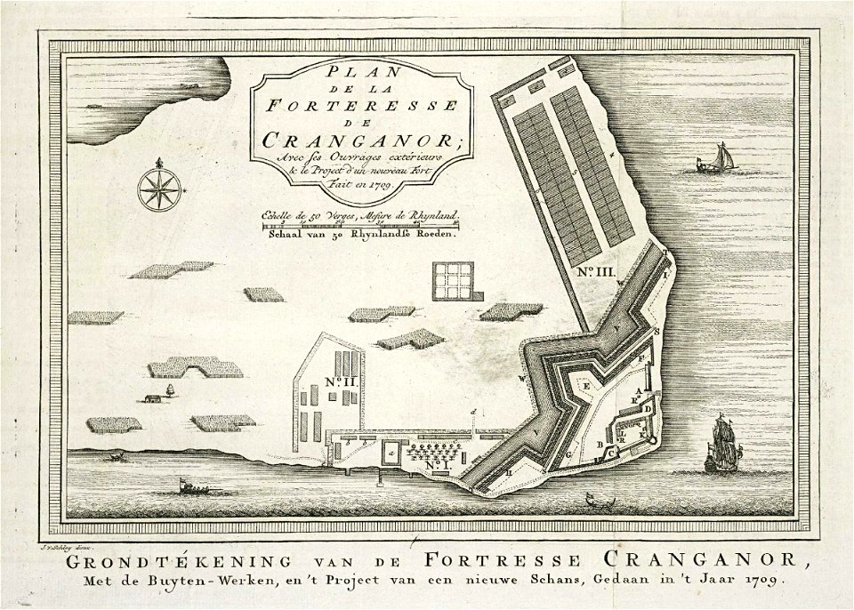
maps of the dutch east india company - india
cranganore fort
japanese art in the metropolitan museum of art
ogata kenzan
japanese art in the metropolitan museum of art
ogata kenzan
japanese art in the metropolitan museum of art
ogata kenzan
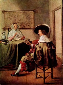
paintings by jan miense molenaer
baroque
atlas maior, vol 3 (germany) - joan blaeu, 1667 - bl 114.h(star).3
copper engraving print
atlas maior, vol 3 (germany) - joan blaeu, 1667 - bl 114.h(star).3
nova & accurata ducatuum slesvici et holsatiae tabula
atlas maior, vol 3 (germany) - joan blaeu, 1667 - bl 114.h(star).3
copper engraving print
atlas maior, vol 3 (germany) - joan blaeu, 1667 - bl 114.h(star).3
copper engraving print
atlas maior, vol 3 (germany) - joan blaeu, 1667 - bl 114.h(star).3
copper engraving print
atlas maior, vol 2 (sweden, russia, poland, eastern europe, and greece) - joan blaeu, 1667 - bl 114.h(star).2
copper engraving print
maps of portugal by fernando álvares seco
eran laor cartographic collection
christmas and winter scenes from the british library mechanical curator collection
christmas in norway
parulidae of the united states
birds of new york (1910)
charles simonneau
engraving
historical images of palais des princes-evêques de liège
maps by willem and johannes blaeu
maps in the british museum
salomon de bray
1642 maps
baroque
maps of the holy land by mercator-hondius
eran laor cartographic collection
maps of the holy land by mercator-hondius
eran laor cartographic collection
maps of the islands of greece by marco boschini (1658)
old maps of samos
maps by willem and johannes blaeu
maps of the duchy of montferrat
a map of the british empire in america with the french and spanish settlements adjacent thereto
bibliothèque nationale de france
maps of ancient italy by philipp clüver
old maps of marche
maps of the islands of greece by marco boschini (1658)
old maps of kalogeros islets
a map of the british empire in america with the french and spanish settlements adjacent thereto
bibliothèque nationale de france
a map of the british empire in america with the french and spanish settlements adjacent thereto
bibliothèque nationale de france
a map of the british empire in america with the french and spanish settlements adjacent thereto
bibliothèque nationale de france
a map of the british empire in america with the french and spanish settlements adjacent thereto
bibliothèque nationale de france
a map of the british empire in america with the french and spanish settlements adjacent thereto
bibliothèque nationale de france
a map of the british empire in america with the french and spanish settlements adjacent thereto
bibliothèque nationale de france
a map of the british empire in america with the french and spanish settlements adjacent thereto
bibliothèque nationale de france
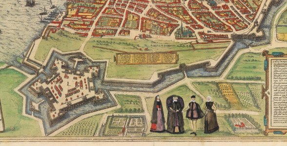
maps of münstermaifeld by braun & hogenberg
maps of cochem by braun & hogenberg
maps of the islands of greece by marco boschini (1658)
old maps of kea (cyclades)
a map of the british empire in america with the french and spanish settlements adjacent thereto
bibliothèque nationale de france
maps of the islands of greece by marco boschini (1658)
old maps of psarà
a map of the british empire in america with the french and spanish settlements adjacent thereto
bibliothèque nationale de france
a map of the british empire in america with the french and spanish settlements adjacent thereto
bibliothèque nationale de france
maps of schwäbisch hall by braun & hogenberg
bibliothèque nationale de france
maps by willem and johannes blaeu
17th-century maps of dombes
maps of halberstadt by braun & hogenberg
maps of quedlinburg by braun & hogenberg
a map of the british empire in america with the french and spanish settlements adjacent thereto
bibliothèque nationale de france
a map of the british empire in america with the french and spanish settlements adjacent thereto
bibliothèque nationale de france
maps of the principality of erbach
maps by pieter van der keere
maps of nové zámky by braun & hogenberg
maps of visegrád by braun & hogenberg
maps of the islands of greece by marco boschini (1658)
old maps of rhodes
maps of moers by johannes mercator
bibliothèque nationale de france
a map of the british empire in america with the french and spanish settlements adjacent thereto
bibliothèque nationale de france
vue (en relief et à vol d'oiseau) de paris by jacques-alphonse testard
maps of paris from bibliothèque nationale de france
maps of formia by braun & hogenberg
bibliothèque nationale de france
a map of the british empire in america with the french and spanish settlements adjacent thereto
bibliothèque nationale de france
descriptio daciarum (17th-century map)
maps by pieter van der keere
maps of haarlem by braun & hogenberg
bibliothèque nationale de france
a map of the british empire in america with the french and spanish settlements adjacent thereto
bibliothèque nationale de france
arnold van langren map of east africa
bibliothèque nationale de france
maps of the islands of greece by marco boschini (1658)
old maps of delos
maps of st. gallen by braun & hogenberg
maps of konstanz by braun & hogenberg
van de velde, 1857
gaza city in art
gatchina park in art
1790s drawings
maps in the stadsarchief amsterdam
hendrik de leth
maps in the stadsarchief amsterdam
hendrik de leth
maps in the stadsarchief amsterdam
hendrik de leth
maps in the stadsarchief amsterdam
hendrik de leth
maps in the stadsarchief amsterdam
dutch golden age painting
pieter jansz. saenredam
grote kerk, haarlem
5501 - 5600 of 9,296
Next page
/ 93